Showing posts with label Storm. Show all posts

Sunday, August 29, 2021

Hurricane Ida strikes Louisiana; New Orleans hunkers down

NEW ORLEANS (AP) — Hurricane Ida blasted ashore Sunday as one of the most powerful storms ever to hit the U.S., blowing off roofs and reversing the flow of the Mississippi River as it rushed from the Louisiana coast toward New Orleans and one of the nation’s most important industrial corridors.

The Category 4 storm hit on the same date Hurricane Katrina ravaged Louisiana and Mississippi 16 years earlier, coming ashore about 45 miles (72 kilometers) west of where Category 3 Katrina first struck land. Ida’s 150-mph (230 kph) winds tied it for the fifth-strongest hurricane to ever hit the mainland U.S.

The rising ocean swamped the barrier island of Grand Isle as landfall came just to the west at Port Fourchon. Ida made a second landfall about two hours later near Galliano. The hurricane was churning through the far southern Louisiana wetlands, with the more than 2 million people living in and around New Orleans and Baton Rouge under threat.

“This is going to be much stronger than we usually see and, quite frankly, if you had to draw up the worst possible path for a hurricane in Louisiana, it would be something very, very close to what we’re seeing,” Gov. John Bel Edwards told The Associated Press.

People in Louisiana woke up to a monster storm after Ida’s top winds grew by 45 mph (72 kph) in five hours as the hurricane moved through some of the warmest ocean water in the world in the northern Gulf of Mexico.

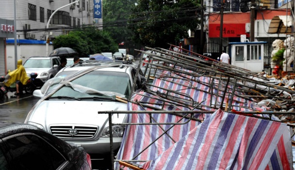
Wind tore at awnings and water spilled out of Lake Ponchartrain in New Orleans on Sunday, and boats broke loose from their moorings. Engineers detected a “negative flow” on the Mississippi River as a result of storm surge, U.S. Army Corps of Engineers spokesman Ricky Boyette said.

Edwards said he watched a live video feed from around Port Fourchon as Ida came ashore.

“The storm surge is just tremendous. We can see the roofs have been blown off of the port buildings in many places,” Edwards told the AP.

Officials said Ida’s swift intensification from a few thunderstorms to a massive hurricane in just three days left no time to organize a mandatory evacuation of New Orleans’ 390,000 residents. Mayor LaToya Cantrell urged residents remaining in the city on Sunday to “hunker down.”

Marco Apostolico said he felt confident riding out the storm at his home in New Orleans’ Lower 9th Ward, one of the city’s hardest-hit neighborhoods when levees failed and released a torrent of floodwater during Katrina.

His home was among those rebuilt with the help of actor Brad Pitt to withstand hurricane-force winds. But the memory of Katrina still hung over the latest storm.

“It’s obviously a lot of heavy feelings,” he said. “And yeah, potentially scary and dangerous.”

The region getting Ida’s worst includes petrochemical sites and major ports, which could sustain significant damage. It is also an area that is already reeling from a resurgence of COVID-19 infections due to low vaccination rates and the highly contagious delta variant.

New Orleans hospitals planned to ride out the storm with their beds nearly full, as similarly stressed hospitals elsewhere had little room for evacuated patients. And shelters for those fleeing their homes carried an added risk of becoming flashpoints for new infections.

Forecasters warned winds stronger than 115 mph (185 kph) threatened Houma, a city of 33,000 that supports oil platforms in the Gulf.

The hurricane was also threatening neighboring Mississippi, where Katrina demolished oceanfront homes. With Ida approaching, Claudette Jones evacuated her home east of Gulfport, Mississippi, as waves started pounding the shore.

“I’m praying I can go back to a normal home like I left,” she said. “That’s what I’m praying for. But I’m not sure at this point.”

Comparisons to the Aug. 29, 2005, landfall of Katrina weighed heavily on residents bracing for Ida. Katrina was blamed for 1,800 deaths as it caused levee breaches and catastrophic flooding in New Orleans. Ida’s hurricane-force winds stretched 50 miles (80 kilometers) from the storm’s eye, or about half the size of Katrina, and a New Orleans’ infrastructure official emphasized that the city is in a “very different place than it was 16 years ago.”

The levee system has been massively overhauled since Katrina, Ramsey Green, deputy chief administrative officer for infrastructure, said before the worst of the storm hit. While water may not penetrate levees, Green said if forecasts of up to 20 inches (50 centimeters) of rain prove true, the city’s underfunded and neglected network of pumps, underground pipes and surface canals likely won’t be able to keep up.

About 530,000 customers were already without power late Sunday afternoon, according to PowerOutage.US, which tracks outages nationwide.

The Louisiana Department of Environmental Quality was in contact with more than 1,500 oil refineries, chemical plants and other sensitive facilities and will respond to any reported pollution leaks or petroleum spills, agency spokesman Greg Langley said. He said the agency would deploy three mobile air-monitoring laboratories after the storm passes to sample, analyze and report any threats to public health.

Louisiana’s 17 oil refineries account for nearly one-fifth of the U.S. refining capacity and its two liquefied natural gas export terminals ship about 55% of the nation’s total exports, according to the U.S. Energy Information Administration. Louisiana is also home to two nuclear power plants, one near New Orleans and another about 27 miles (about 43 kilometers) northwest of Baton Rouge.

President Joe Biden approved emergency declarations for Louisiana and Mississippi ahead of Ida’s arrival. He said Sunday the country was praying for the best for Louisiana and would put its “full might behind the rescue and recovery” effort once the storm passes.

Edwards warned his state to brace for potentially weeks of recovery.

“Many, many people are going to be tested in ways that we can only imagine today,” the governor told a news conference.___

Reeves reported from Gulfport, Mississippi. Associated Press writers Rebecca Santana, Stacey Plaisance and Janet McConnaughey in New Orleans; Emily Wagster Pettus in Jackson, Mississippi; Jeff Martin in Marietta, Georgia; Seth Borenstein in Kensington, Maryland; Frank Bajak in Boston; Michael Biesecker in Washington; Pamela Sampson in Atlanta; and Jeffrey Collins in Columbia, South Carolina, contributed to this report.

-Associated Press

Monday, June 1, 2020

Deadly Tropical Storm Amanda hits El Salvador, Guatemala


Tropical Storm Amanda triggered flash floods, landslides and power outages as it barrelled through El Salvador and Guatemala Sunday, killing 14 people, authorities said, warning of further heavy rain to come.

El Salvador President Nayib Bukele declared a 15-day state of emergency to cope with the effects of the storm, which he estimated to have caused $200 million in damage, but which weakened later in the day as it moved into Guatemala.

Amanda, the first named storm of the season in the Pacific, unleashed torrents of floodwater that tossed vehicles around like toys and damaged about 200 homes, the head of the Civil Protection Service William Hernandez said.

The fatalities were all recorded in El Salvador, Interior Minister Mario Duran said, warning that the death toll could rise.

One person is still missing, senior government official Carolina Recinos added.

"We are experiencing an unprecedented situation: one top-level emergency on top of another serious one," San Salvador mayor Ernesto Muyshondt said, referring to the coronavirus pandemic.

He added that half of those killed died in the capital, and that 4,200 people had sought refuge in government-run shelters after losing their homes or being forced to leave because they were in high-risk areas.

In some flooded areas, soldiers worked alongside emergency personnel to rescue people.

"We lost everything, we've been left with nowhere to live," said Isidro Gomez, a resident of hard-hit southeastern San Salvador, after a nearby river overflowed and destroyed his home.

Another victim, Mariano Ramos, said that at dawn residents of his San Salvador neighborhood were slammed by an avalanche of mud and water. An elderly man died in the area, officials said.

El Salvador's environment ministry warned residents of the "high probability" of multiple landslides that could damage buildings and injure or kill people.

Nearly 90 percent of El Salvador's 6.6 million people are considered vulnerable to flooding and landslides due to its geography.

In neighboring Guatemala, officials said roads had been blocked by at least five landslides and some flooding was reported, but no evacuations were underway.

Even though Amanda weakened to tropical depression status, Guatemalan officials warned that heavy rain would continue, with swollen rivers and possible "landslides affecting highways ... and flooding in coastal areas."

Agence France-Presse

Monday, September 17, 2018

Massive clean-up in Hong Kong after typhoon brings trail of destruction


HONG KONG, China — Hong Kong began a massive clean-up Monday after Typhoon Mangkhut raked the city, shredding trees and bringing damaging floods, in a trail of destruction that has left dozens dead in the Philippines and millions evacuated in southern China.

The death toll in the Philippines, where the main island of Luzon was mauled with fierce winds and rain, rose to 65 overnight as rescuers pulled more bodies from a huge landslide in the mountain town of Itogon.

National police spokesman Senior Superintendent Benigno Durana told AFP that 43 other people are missing, and more than 155,000 people remain in evacuation centres two days after the typhoon struck.

After tearing through Luzon and pummelling Hong Kong and Macau, the storm made landfall in mainland China late Sunday, with two reported dead in Guangdong province.

Authorities there said they had evacuated more than three million people and ordered tens of thousands of fishing boats back to port before the arrival of what Chinese media had dubbed the "King of Storms".

In the high-rise city of Hong Kong, the government described the damage as "severe and extensive" with more than 300 people injured in Mangkhut which triggered the maximum "T10" typhoon alert.

The monumental task of cleaning up the city began as residents, some in suits and ties, struggled to get back to work on roads that remained blocked by felled trees, mud and debris.

Schools were closed, along with bus services, and travel disruption saw commuters piling onto platforms trying to board infrequent trains after trees fell on overhead lines.

Landslides and severe flooding affected some areas, with over 1,500 residents seeking refuge in temporary shelters overnight.

The storm, with gusts of more than 230 kilometers per hour (142 mph), sent buildings swaying and waters surging into homes and shopping malls, with some roads waist-deep in water.

Windows in tower blocks and skyscrapers were smashed as people cowered inside.

In the neighbourhood of Heng Fa Chuen, thousands of rocks and pebbles from the sea covered parkland along the coastline which had been battered by pounding waves.

The city's main Victoria Park had become an obstacle course with hundreds of trees down and many completely uprooted.

Emergency teams were sawing apart some of the biggest trees blocking roads and pathways across the city in a clean-up operation that is likely to take days.

In the neighboring gambling enclave of Macau, all 42 casinos shut down for the first time in its history as the storm approached.

They opened again on Monday but Macau was still in recovery mode after severe flooding hit parts of the city, forcing emergency workers to rescue people from their shops and homes using boats and jetskis.

As the storm moved past the enclave Sunday, streets became submerged under water gushing in from the harbour.

The government and casinos have taken extra measures in recent times,  determined to avoid a repeat of Typhoon Hato which battered Macau last year, killing 12 people and drawing accusations it was ill prepared for a major storm.

source: philstar.com

Friday, December 25, 2015

Mississippi declares emergency as storms in US South kill 11 on Christmas Eve


Southern US states began digging out on Thursday after severe storms killed at least 11 people, and Mississippi declared a state of emergency in areas pounded by tornadoes.

With about 100 million Americans expected to travel over the Christmas holiday, the National Weather Service forecast isolated severe thunderstorms from the mid-Atlantic region to the Gulf Coast and record warmth in New York.

The storm system packed high winds and triggered more than 20 tornadoes in Arkansas, Illinois, Indiana, Mississippi, Tennessee and Michigan on Wednesday, authorities said.

A large tornado tore a 100-mile (160-km) path through northern Mississippi, demolishing or heavily damaging more than 100 homes and other buildings before plowing into western Tennessee, authorities said.

Mississippi Governor Phil Bryant declared a state of emergency in areas affected by the storm, saying 14 tornadoes had touched down in the state. Bryant said seven people were killed and one person was missing.

"Everybody is pulling together here in Mississippi today to help respond to this disaster," Bryant said on CNN.

He said shelters had been set up and the full extent of the damage would not be known for several days. Mississippi authorities said some 40 people were injured and a 7-year-old boy was among those killed.

Three people died in Tennessee and an 18-year-old woman was killed in Arkansas when a tree crashed into her house, authorities said.

Thirteen counties in Tennessee suffered severe damage, with a post office destroyed and a state highway washed out.

Emergency crews in Mississippi, Alabama, and Tennessee were searching for several people reported missing. Scores were injured in the region.

A rare tornado touched down in Canton, Michigan, and about 15,000 homes in the state and neighboring Wisconsin were without electricity. The weather service issued a gale force wind warning for Lake Michigan, where waves could reach 15 feet.

About 500 flights were delayed or canceled at Atlanta's Hartsfield-Jackson airport as the area was hit by a thunderstorm.

Meanwhile, much of the northeast enjoyed balmy weather on Thursday, including New York, which surpassed its record for the warmest Christmas Eve reaching 71 degrees Fahrenheit (22 C).

Cold and snow were forecast on Christmas Day for the US Northwest, including temperatures in the teens in Montana and snow likely in Washington, Oregon, northern California, and Nevada.

Of the 100 million Americans traveling over the holiday, 91 million will use cars, according to the American Automobile Association.

source: interaksyon.com

Saturday, November 8, 2014

Prayers, tears in Philippines one year after super typhoon


MANILA - Survivors of the strongest typhoon ever to hit land descended on mass graves Saturday to mark one year since the storm devastated the central Philippines and condemned millions to deeper poverty.

Super Typhoon Haiyan (Yolanda) claimed more than 7,350 lives as it swept in off the Pacific Ocean, with its record winds and once-in-a-generation storm surges flattening entire towns.

The typhoon tore across a corridor of islands where about 14 million people lived in farming and fishing communities that were already among the nation's poorest.

The rebuilding effort has been painfully slow for most survivors, with millions poorer and many dangerously exposed to the next big storm as they still live in shanty homes along coastal areas.

In an outpouring of grief, tens of thousands marched to the grave sites under the hot sun on Saturday to offer flowers, light candles and say prayers.

Josephine Crisostomo's three children died during the storm, including her youngest, who would have turned two years old on Sunday.

"I miss my children terribly, especially John Dave who would have celebrated his birthday tomorrow... I miss you, son, I love you so much," Crisostomo, 41, said at one of the mass graves in the outskirts of badly-hit Tacloban city.

Using felt-tip pens, mourners wrote names of those who died on the hundreds of white crosses planted on parched earth in symbolic gestures as the more than 2,000 people buried there had not been identified.

"I am looking for my brother, but his name is not on the list of those buried here," Elena Olendan, 50, told AFP, her eyes welling with tears, as she wandered around the grave site, about the size of six basketball courts.

Olendan had not reported her 60-year-old brother, Antonio, as missing when Haiyan struck. She found a cross on the far end of the mass grave and wrote her brother's name on it.

National day of prayer

The Philippines is a mainly Catholic country and many people in the typhoon zones, as well as across the nation, attended special church services.

The Catholic Bishops Conference of the Philippines declared Saturday a national day of prayer, and church bells across the nation would ring at 6:00 pm to remember those who died or suffered in the storm.

The build-up to the anniversary had focused renewed attention on the pace of the reconstruction effort, with President Benigno Aquino's government criticised by many for a perceived lack of urgency.

Roughly one million people need to be moved away from coastal areas that are deemed vulnerable to storm surges, according to a 160-billion-peso ($3.6-billion) government master plan for rebuilding the typhoon zones.

However those plans have already fallen behind schedule, delayed by problems in finding new land that is safe and suitable for 205,000 new homes.

In a speech at the typhoon-hit town of Guiuan on Friday, Aquino defended the pace of the reconstruction programme, saying he was determined to ensure it was carried out correctly rather than rushing.

"Curse me, criticize me but I believe I must do the right thing," Aquino said.

"I am impatient like everyone else but I have to stress that we can't rebuild haphazardly. We have to build back better... let's get it right the first time and the benefits should be permanent."

Aquino also cited international aid agencies as saying post-Haiyan recovery efforts were moving faster compared with programs in Indonesia's Banda Aceh after it was hit by mega-tsunami waves in 2004.

And while millions endure Haiyan-exacerbated poverty, there has been some remarkable progress from a year ago as international aid agencies have pumped hundreds of millions of dollars into the region.

Some of the big successes of the campaign have been the restoration of electricity within a few months, quick replanting of crops and sanitation programmes that prevented major outbreaks of killer diseases.

source: interaksyon.com

Tuesday, July 8, 2014

One dead as Neoguri hits Japan's Okinawa


TOKYO -  One man died, more than 500,000 people were urged to evacuate and hundreds of flights were canceled as a strong typhoon brought torrential rain and high winds to its southwestern islands and could bring heavy rain to Tokyo later this week.

Typhoon Neoguri weakened from its original status as a super typhoon but remained intense, with gusts of more than 250 km per hour (155 mph). It was powering through the Okinawa island chain where emergency rain and high-seas warnings were in effect.


Hundreds of flights were cancelled in Japan and more than 500,000 people urged to evacuate as a powerful typhoon brought torrential rain and high winds to southwestern islands and was forecast to reach Tokyo later in the week.

The storm will be at its most powerful as it passes Okinawa, some 1,600 km (1,000 miles) southwest of Tokyo on Tuesday, but the Japan Meteorological Agency (JMA) warned of heavy rains and potential flooding in Kyushu, the westernmost of Japan's main islands, as well as heavy rain in the rest of the nation as the storm turns east.

"People must take the utmost caution," Keiji Furuya, state minister in charge of disaster management, told a news conference.

One man was missing after his boat was swamped by high waves, NHK national television said. Several people suffered minor injuries from falls.

More than 50,000 households in Okinawa lost power and an oil refinery halted operations. Television footage showed street lights rocking in high winds and branches being blown down largely deserted streets.

There are no nuclear plants on Okinawa but there are two on Kyushu, which lies in the area through which the typhoon is likely to pass after hitting Okinawa. There is another on Shikoku island, which borders Kyushu and could also be affected.

All are shut down due to national policy and the Fukushima Daiichi nuclear plant, which was wrecked by an earthquake and tsunami in March 2011, is on the other side of the country.

"When the wind blows most strongly, it's impossible to stand. You have to hold on to something," said Kei Shima, a self-employed Okinawa resident in her 30s.

"The lights are fading in and out, like the house is haunted. The rain is getting stronger and falling sideways."

Neoguri was roughly 110 km (68 miles) southwest of Kumejima of island at noon (0300 GMT) and moving north at 25 kph (16 mph), with sustained winds of 180 kph (110 mph).

Kadena Air Base, one of the largest U.S. military facilities on Okinawa, was on its highest level of storm alert and all outside activity was prohibited.

Nansei Sekiyu KK, a Japanese refiner wholly owned by Brazil's Petrobras, said it had suspended oil refining operations at its 100,000 barrels-per-day Nishihara refinery in Okinawa on Monday evening.

A JMA official said the storm will maintain its strength as it heads north but gradually turn to the east, making landfall in Kyushu before raking its way up the main island of Honshu and coming close to Tokyo on Friday.

"But it will be weaker by then, so that Tokyo can mainly expect a lot of rain, and maybe some gusts of wind," he added.

Around two to four typhoons make landfall in Japan each year but they are unusual in July.

source: interaksyon.com

Sunday, November 10, 2013

Australian among Yolanda dead - Australia foreign affairs


SYDNEY - An Australian man widely identified as a former priest who blew the whistle on child sex abuse in the Catholic Church is among the dead from a typhoon that devastated the Philippines, according to reports.

The department of foreign affairs on Sunday said a 50-year-old New South Wales man had been killed, although it declined to confirm his identity.

But the Australian Broadcasting Corporation and other media said he was former priest Kevin Lee, who was removed from his parish responsibilities in Sydney last year after admitting to marrying a woman in secret.

Lee spoke out about abuse in the Catholic Church on an ABC program, Unholy Silence, last year. He was believed to be living in the Philippines with his Filipina wife and young baby.

Super typhoon Yolanda (international name: Haiyan) ripped through the Philippines and is now bearing down on Vietnam. A regional Philippine police chief on Sunday said 10,000 people were believed to have killed in one province alone.

source: interaksyon.com

Saturday, February 9, 2013

Blizzard wallops US Northeast, closes roads


BOSTON/NEW YORK - A blizzard slammed into the northeastern United States on Friday, snarling traffic, disrupting thousands of flights and prompting five governors to declare states of emergency in the face of a fearsome snowstorm.

The storm caused a massive traffic pile-up in southern Maine. Organizers of the US sledding championship in that state postponed a race scheduled for Saturday, fearing too much snow for the competition.

The blizzard left about 10,000 along the East Coast without power. Almost 3,500 flights were canceled and officials in Massachusetts and Connecticut closed roads.

Forecasters warned about 2 feet of snow would blanket most of the Boston area with some spots getting as much as 30 inches. The city's record snowfall, 27.6 inches, came in 2003.

"We're seeing heavier snow overspread the region from south to north," said Lance Franck, a meteorologist with the National Weather Service in Taunton, Massachusetts, outside Boston. "As the snow picks up in intensity, we're expecting it to fall at a rate of upwards of two to three inches per hour."

Early Friday evening, officials warned that the storm was just ramping up to full strength, and that heavy snow and high winds would continue through midday on Saturday. The governors of Massachusetts, Rhode Island, Connecticut, New York and Maine declared states of emergency and issued bans on driving by early Friday afternoon.

Authorities ordered nonessential government workers to stay home, urged private employers to do the same, told people to prepare for power outages and encouraged them to check on elderly or disabled neighbors.

People appeared to take the warnings seriously. Traffic on streets and public transportation services was significantly lighter than usual on Friday.

"This is a very large and powerful storm, however we are encouraged by the numbers of people who stayed home today," Boston Mayor Thomas Menino told reporters.

Even so, the storm caused a few accidents, including a 19-vehicle pile-up outside Portland, Maine, that sent one person to the hospital.

Winds were blowing at 35 to 40 miles per hour by Friday afternoon and forecasters expected gusts up to 60 miles per hour as the evening wore on.

As he waited for one of the last subways that ran through the Boston area, musician John Hinson, who was visiting from Durham, North Carolina, said he had never seen a storm of the magnitude Friday's blizzard was expected to reach.

"I've been through some snow, a couple feet, but not anything like they're predicting, which is kind of exciting," he said.

Looking for Sasquatch

The storm wasn't bad news for everyone.

When told an estimated 8 to 10 inches were predicted overnight at Elk Mountain in Uniondale, Pennsylvania, pint-sized skier Sophia Chesner's eye grew wide.

"Whoa!" said the 8-year old, of Moorestown, New Jersey, who was on a ski vacation with her family. Her sister, Giuliana, 4, said no matter how good the skiing is, she has other outer priorities once the snow piles up.

"First thing I'm going to do is build a snowman and look for a Sasquatch footprint," Guiliana Chesner said.

Life was not as rosy for those who planned to fly. Almost 3,500 flights were canceled on Friday, with more than 1,200 planned cancellations for Saturday, according to the website FlightAware.com.

The storm also posed a risk of flooding at high tide to areas still recovering from superstorm Sandy last fall.

"Many of the same communities that were inundated by Hurricane Sandy's tidal surge just about 100 days ago are likely to see some moderate coastal flooding this evening," said New York Mayor Michael Bloomberg.

About one foot of snow was forecast to land on New York City.

Brick Township in New Jersey had crews out building up sand dunes and berms ahead of a forecast storm surge, said Mayor Stephen Acropolis.

Travel became more difficult as the day progressed. Massachusetts started closing its public transportation system at 3:30 p.m. (2030 GMT) and ordered most drivers off roads by 4 p.m. (5.00 p.m. GMT) Connecticut also closed its roads.

The Amtrak railroad suspended service between New York, Boston and points north on Friday afternoon.

Organizers of the country's championship sledding race, which had been scheduled to get underway in Camden, Maine, on Saturday, postponed the event by one day. Some 400 teams were registered for the race, which features costumed sledders on a 400-foot (121 meter) chute.

"As soon as the weather clears on Saturday and it is safe, the toboggan committee will be out at Tobagganville cleaning up the chute as quickly as they can," said Holly Edwards, chairman of the US National Toboggan Championships.

"It needs to be shoveled out by hand." (Additional reporting by Barbara Goldberg in Uniondale, Pennsylvania, Daniel Lovering in Cambridge, Massachusetts, Jason McLure in Littleton, New Hampshire, David Sheppard, Robert Gibbons and Scott DiSavino in New York and Dave Warner in Philadelphia)


source: interaksyon.com

Tuesday, December 25, 2012

Storm brings white Christmas, tornado threat to central US


WASHINGTON - A major winter storm brought a rare white Christmas to the southern US plains on Tuesday, contributing to a 21-vehicle pile-up that shut down a major highway in Oklahoma.

The storm system surging east from Kansas and the Texas Panhandle includes the threat of tornados and severe thunderstorms along its southern fringe, from southeast Texas to Alabama, the National Weather Service said.

The storm is expected to bring blizzard conditions and 6 to 8 inches of snow as it strengthens and moves northeast into the upper Ohio River valley through southern Missouri and Illinois, it said.

Freezing drizzle overnight led to 10 separate collisions on Interstate 40 at Oklahoma City just before 3 a.m., said Trooper Betsy Randolph, a spokeswoman for the Oklahoma Highway Patrol.

The 21-vehicle pile-up included three tractor-trailers and shut down the westbound lanes for about five hours, she said. Twelve people were taken to hospitals, and troopers are checking on the severity of their injuries.

In a rare taste of Christmas snow, Oklahoma City is forecast to get 3 to 6 inches of the white stuff on Tuesday. The city's biggest Christmas snowfall was 6.5 inches in 1914, and measurable amounts have been recorded only a handful of times on the date.

Several flights were canceled at Oklahoma City's Will Rogers World Airport on Monday ahead of the storm, but conditions on Tuesday morning were good, the airport said in a statement.

Ahead of the storm's path, parts of eastern West Virginia are under a winter storm warning. Ice accumulations of up to half an inch are expected in higher elevations, the National Weather Service said.

source: interaksyon.com

Tuesday, October 30, 2012

Sandy wreaks havoc across Northeast; at least 11 dead


(CNN) -- Though no longer a hurricane, "post-tropical" superstorm Sandy packed a hurricane-sized punch as it slammed into the Jersey Shore on Monday, killing at least 11 people from West Virginia to North Carolina and Connecticut.

Sandy whipped torrents of water over the streets of Atlantic City, stretching for blocks inland and ripping up part of the vacation spot's fabled boardwalk. The storm surge set records in Lower Manhattan, where flooded substations caused a widespread power outage. It swamped beachfronts on both sides of Long Island Sound and delivered hurricane-force winds from Virginia to Cape Cod as it came ashore.

Sandy's wrath also prompted the evacuation of about 200 patients at NYU Langone Medical Center.

"We are having intermittent telephone access issues, and for this reason the receiving hospital will notify the families of their arrival," spokeswoman Lisa Greiner said.

In addition, the basement of New York's Bellevue Hospital Center flooded, and the hospital was running off of emergency backup power. Ian Michaels of the Office of Emergency Management said the main priority is to help secure additional power and obtain additional fuel and pumps for the hospital.

The storm hit near Atlantic City about 8 p.m. ET, the National Hurricane Center reported. It packed 80-mph winds at landfall, down from the 90 mph clocked earlier Monday.

Superstorm Sandy's wrath

"I've been down here for about 16 years, and it's shocking what I'm looking at now. It's unbelievable," said Montgomery Dahm, owner of the Tun Tavern in Atlantic City, which stayed open as Sandy neared the Jersey Shore. "I mean, there's cars that are just completely underwater in some of the places I would never believe that there would be water."

Dahm's family cleared out of Atlantic City before the storm hit, but he says he stayed put to serve emergency personnel. At nightfall Monday, he said the water was lapping at the steps of his restaurant, where a generator was keeping the lights on.


The storm had already knocked down power lines and tree limbs while still 50 miles offshore and washed out a section of the boardwalk on the north end of town, Atlantic City Mayor Lorenzo Langford told CNN. He said there were still "too many people" who didn't heed instructions to evacuate, and he urged anyone still in town to "hunker down and try to wait this thing out."

"When Mother Nature sends her wrath your way, we're at her mercy, and so all we can do is stay prayerful and do the best that we can," Langford said.

And in Seaside Heights, about 30 miles north of Atlantic City, Police Chief Thomas Boyd told CNN, "The whole north side of my town is totally under water."


In New York, lower Manhattan's Battery Park recorded nearly 14-foot tide, smashing a record set by 1960's Hurricane Donna by more than 3 feet. The city had already halted service on its bus and train lines, closing schools and ordering about 400,000 people out of their homes in low-lying areas of Manhattan and elsewhere.

Flooding forced the closure of all three of the major airports in the area, LaGuardia, John F. Kennedy and Newark Liberty. Water seeped into subway stations in Lower Manhattan and into the tunnel connecting Lower Manhattan and Brooklyn, while high winds damaged a crane perched atop a Midtown skyscraper under construction, forcing authorities to evacuate the surrounding area.

New York Mayor Michael Bloomberg told reporters there was an "extraordinary" amount of water in Lower Manhattan, as well as downed trees throughout the city and widespread power outages.

"We knew that this was going to be a very dangerous storm, and the storm has met our expectations," he said. "The worst of the weather has come, and city certainly is feeling the impacts."

The storm was blamed for more than 2.8 million outages across the Northeast. About 350,000 of them were in the New York city area, where utility provider Con Edison reported it had also cut power to customers in parts of Brooklyn and Lower Manhattan to protect underground equipment as the storm waters rose.

But as water crept into its substations, Con Ed said it had lost service to about 250,000 customers in Manhattan -- including most of the island south of 39th Street.

Five things to know about Sandy

At least five people had been killed in storm-related incidents in New York state, including three killed by trees falling on homes in Queens and in the town of New Salem, near Albany, city and state officials said. Falling trees were also blamed for three deaths reported in New Jersey and one in Connecticut, authorities there told CNN.

In West Virginia, a woman was killed in a car accident after the storm dumped 5 inches of snow on the town of Davis, said Amy Shuler Goodwin, a spokeswoman for Gov. Earl Ray Tomblin's office.


And before hitting land, it overwhelmed the sailing ship HMS Bounty, a replica of the historic British vessel, off North Carolina. Fourteen of the ship's crew of 16 were rescued, but the body of one deckhand was found Monday evening and the ship's captain was still missing Monday night, the Coast Guard said.

Sandy had already claimed at least 67 lives in the Caribbean, including 51 in Haiti.

Sandy's storm surges were boosted by a full moon, which already brings the highest tides of the month. And forecasters said the storm was likely to collide with a cold front and spawn a superstorm that could generate flash floods and snowstorms.

"It could be bad," said U.S. Coast Guard Rear Adm. Steven Rattior, "or it could be devastation."

Mass transit shut down across the densely populated Northeast, landmarks stood empty and schools and government offices were closed. The National Grid, which provides power to millions of customers, said 60 million people could be affected before it's over.

On Fire Island, off Long Island, the water rose above promenades and docks on Monday afternoon, homeowner Karen Boss said. Boss stayed on the island with her husband despite a mandatory evacuation order. She said they own several properties and a business there and had weathered previous storms.

"I'm concerned that it might come into the first floor," she said. "If that's the case, I'll just move into another house that's higher up."

Based on pressure readings, it's likely to be the strongest storm to make landfall north of Cape Hatteras, North Carolina, CNN senior meteorologist Dave Hennen said. The benchmark storm, the 1938 "Long Island Express" Hurricane, contained a low pressure reading of 946 millibars; Sandy had a minimum pressure of 943 millibars. Generally speaking, the lower the pressure, the stronger the storm.

In Sea Bright, New Jersey, Yvette Cafaro scrawled a plea on the plywood that covered her burger restaurant: "Be kind to us Sandy." The seaside area largely dodged last year's Hurricane Irene, but Cafaro was not optimistic that Sea Bright would be spared Sandy.


"Everything that we've been watching on the news looks like this one will really get us," she said. "We're definitely worried about it."


Its arrival, eight days before the U.S. presidential election, forced President Barack Obama and his Republican challenger, Mitt Romney, to alter or cancel several campaign stops. Obama flew back to Washington from Florida, telling reporters at the White House that assets were in place for an effective response to the storm.

"The most important message I have for the public right now is please listen to what your state and local officials are saying," Obama said. "When they tell you to evacuate, you need to evacuate."

And in Ohio, Romney asked supporters to drop off items and cash at his "victory centers" to be donated to victims of the storm.

"There are families in harm's way that will be hurt -- either in their possessions or perhaps in something more severe," Romney said.


By Monday afternoon, 23 states were under a warning or advisory for wind related to Sandy. Thousands of flights had been canceled, and hundreds of roads and highways were expected to flood. And according to a government model, Sandy's wind damage alone could cause more than $7 billion in economic loss.

Sandy was expected to weaken once it moves inland, but the center was expected to move slowly northward, meaning gusty winds and heavy rain would continue through Wednesday.

On the western side of the storm, the mountains of West Virginia expected up to 3 feet of snow and the mountains of southwestern Virginia to the Kentucky state line could see up to 2 feet. Twelve to 18 inches of snow were expected in the mountains near the North Carolina-Tennessee border.

"This is not a typical storm," said Pennsylvania Gov. Tom Corbett. "Essentially, this is a hurricane wrapped in a 'nor'easter.'"

source: CNN


Monday, October 29, 2012

Hurricane Sandy strengthens as it nears US East Coast

NEW YORK - Hurricane Sandy, the monster storm bearing down on the East Coast, strengthened on Monday after hundreds of thousands moved to higher ground, public transport shut down and the stock market suffered its first weather-related closure in 27 years.

About 50 million people from the Mid-Atlantic to Canada were in the path of the nearly 1,000-mile-wide (1,600-km-wide) storm, which forecasters said could be the largest to hit the mainland in US history. It was expected to topple trees, damage buildings, cause power outages and trigger heavy flooding.

The US National Hurricane Center (NHC) said on Monday the Category 1 storm had strengthened as it turned toward the coast and was moving at 20 miles per hour (32 km per hour). It was expected to bring a "life-threatening storm surge," coastal hurricane winds and heavy snow in the Appalachian Mountains, the NHC said.

Nine US states have declared states of emergency, and with the US election eight days away President Barack Obama canceled a campaign event in Florida on Monday in order to return to Washington and monitor the US government's response to the storm.

"This is a serious and big storm," Obama said on Sunday after a briefing at the federal government's storm response center in Washington. "We don't yet know where it's going to hit, where we're going to see the biggest impacts."

Sandy killed 66 people in the Caribbean last week before pounding US coastal areas with rain and triggering snow falls at higher elevations as it moved north.

Forecasting services indicated early Monday the center of the storm would strike the New Jersey shore near Atlantic City on Monday night. While Sandy does not pack the punch of Hurricane Katrina, which devastated New Orleans in 2005, it could become more potent as it approaches the US coast.

Winds were at a maximum of 85 mph, the NHC said in its 8 a.m. (1200 GMT) report, up from 75 mph six hours earlier. It said tropical storm-force winds reached as far as 485 miles from the center.

Seventeen people from the replica HMS Bounty abandoned ship while stranded at sea off North Carolina in the path of the hurricane, roughly 160 miles from the center of storm, the US Coast Guard said on Monday.

"The 17-person crew donned cold water survival suits and lifejackets before launching in two 25-man lifeboats with canopies," the Coast Guard said, adding it was determining which aircraft or vessel was best-placed to launch a rescue.

The three-masted tall ship was built for the 1962 movie "Mutiny on the Bounty."

New York and other cities and towns closed their transit systems and ordered mass evacuations from low-lying areas ahead of a storm surge that could reach as high as 11 feet.

All US stock markets will be closed on Monday and possibly Tuesday, the operator of the New York Stock Exchange said late on Sunday, reversing an earlier plan that would have kept electronic trading going on Monday.

The United Nations, Broadway theaters, New Jersey casinos, schools up and down the Eastern Seaboard, and myriad corporate events were also being shut down.

'Don't be stupid'

Officials ordered people in coastal towns and low-lying areas to evacuate, often telling them they would put emergency workers' lives at risk if they stayed.

"Don't be stupid, get out, and go to higher, safer ground," New Jersey Governor Chris Christie told a news conference.

Forecasters said Sandy was a rare, hybrid "super storm" created by an Arctic jet stream wrapping itself around a tropical storm, possibly causing up to 12 inches of rain in some areas, as well as up to 3 feet (1 meter) of snowfall in the Appalachian Mountains from West Virginia to Kentucky.

At 8 a.m. (1200 GMT), the NHC said Sandy was centered about 265 miles southeast of Atlantic City and about 310 miles south-southeast of New York City.

Worried residents in the hurricane's path packed stores, searching for generators, flashlights, batteries, food and other supplies in anticipation of power outages. Nearly 284,000 residential properties valued at $88 billion are at risk for damage, risk analysts at CoreLogic said.

Transportation systems shut down in anticipation. Airlines canceled flights, bridges and tunnels closed, and national passenger rail operator Amtrak suspended nearly all service on the East Coast. The US government told non-emergency workers in Washington, D.C., to stay home.

Utilities from the Carolinas to Maine reported late Sunday that a combined 14,000 customers were already without power.

The second-largest oil refinery on the East Coast, Phillips 66's 238,000 barrel per day (bpd) Bayway plant in Linden, New Jersey, was shutting down and three other plants cut output as the storm affected operations at two-thirds of the region's plants.

Oil prices slipped on Monday, with Brent near $109 a barrel. "With refineries cutting runs, we're likely to see a build-up in crude stocks which could be driving bearish prices at the moment," said Michael Creed, an economist at National Australia Bank in Melbourne.

New York City Mayor Michael Bloomberg ordered the evacuation of some 375,000 people from low-lying areas of the city, from upscale parts of lower Manhattan to waterfront housing projects in the outer boroughs.

While Sandy's 85 mph winds were not overwhelming for a hurricane, its exceptional size means the winds will last as long as two days.

"This is not a typical storm," Pennsylvania Governor Tom Corbett said. "It could very well be historic in nature and in scope." (Additional reporting by John McCrank, Edith Honan, Caroline Humer, Paul Thomasch and Janet McGurty in New York; Barbara Goldberg in New Jersey; Gene Cherry in North Carolina; Dave Warner in Philadelphia; Tom Hals in Milford, Delaware; Mary Ellen Clark and Ebong Udoma in Connecticut; Matt Spetalnick in Washington)

source: interaksyon.com

Sunday, August 26, 2012

US Gulf states on heightened alert over Isaac


TAMPA, Florida - Three US Gulf Coast states declared states of emergency on Sunday as Tropical Storm Isaac barreled toward land, threatening to slam into Louisiana as a damaging hurricane.

The governors of Louisiana, Mississippi, and Alabama issued their declarations as Florida, which declared a state of emergency a day earlier, was drenched by heavy rains and strong winds from the storm.

The declarations make funds available to respond to the storm and order government agencies to implement emergency preparedness plans.

A hurricane warning was in effect east of Morgan City Louisiana to Destin, Florida, including metropolitan New Orleans, which is marking the seventh anniversary of Hurricane Katrina, which devastated the city and killed around 1,800 people.

The storm is forecast to hit as a category two hurricane on the five-point Saffir-Simpson scale -- with top winds swirling at 96-110 miles (83-95 kilometers) per hour -- when it makes landfall.

"We are encouraging everyone to get prepared now to ensure that you have an evacuation plan in place, plenty of water, non-perishable food items, hygiene supplies, sufficient clothing and any prescription medications you or your family may need in the event of the storm," Louisiana Governor Bobby Jindal said in a statement.

"As with every storm, we always hope for the best and prepare for the worst."

He recommended voluntary evacuations within the hurricane watch area, which includes low-lying areas, those zones outside of levee protection and areas south of the Intracoastal Waterway.

Alabama Governor Robert Bentley said he was mobilizing the resources that his community needed as the storm approached.

"I am urging everyone to take precautions now, monitor weather warnings and be prepared for whatever Isaac may bring," he said.

Bentley ordered mandatory evacuations in parts of Mobile and Baldwin Counties.

Alabama Emergency Management Agency Director Art Faulkner urged residents to "make preparations now for the potential impact of strong winds and heavy rains."

The National Hurricane Center has also issued both a tropical storm warning and a hurricane warning for multiple counties in Mississippi.

Mississippi Governor Phil Bryant authorized the state's National Guard to deploy 10 members of its civil support team to coastal counties, and urged residents to finalize their preparations.

"We are taking the threat of impact from Isaac seriously, and we are working to ensure that Mississippi is well-prepared," Bryant said.

"Sound preparations will enable us to ramp up our response without losing time if the situation worsens."

source: interaksyon.com

Wednesday, August 8, 2012

Typhoon Haikui strikes east coast of China


(CNN) -- Typhoon Haikui slammed into the east coast of China on Wednesday morning, pummeling the area around the business metropolis of Shanghai with heavy wind and rain.

The storm's winds were at "severe typhoon" strength when it made landfall in the province of Zhejiang, about 225 kilometers (140 miles) south of Shanghai, the China Meteorological Administration said. The winds diminished to typhoon strength as Haikui moved inland.

A severe typhoon is considered to have maximum sustained wind speed of between 150 and 184 kilometers per hour (93 and 114 mph). A typhoon has maximum sustained winds of between 118 and 149 kilometers per hour (73 and 93 mph).


Hundreds of thousands of people had been evacuated from Haikui's path as it approached, the third tropical cyclone to hit China's east coast in less than a week.

Chinese officials had relocated 374,000 people from Shanghai and 250,000 from Zhejiang, according to the state-run newspaper China Daily.

Although the storm's winds are expected to weaken as it moves overland, it will continue to dump large amounts of rain on the surrounding area, raising the risk of landslides and flooding.

"The rain is the bigger impact going forward," said CNNI Meteorologist Taylor Ward. "We have already had up to 8 inches in some locations."

Ward said another 6 to 10 inches of rain were expected to fall, with "maybe isolated amounts greater."

Haikui was moving northwest at 20 kph (12 mph) but was expected to slow over the coming two days, he said.

source: CNN


Saturday, June 30, 2012

Eastern U.S. Storms Leave 2 Dead, 2 Million Without Power

Violent evening storms following a day of triple-digit temperatures wiped out power to more than 2 million people across the eastern United States and caused two fatalities in Virginia — including a 90-year-old woman asleep in bed when a tree slammed into her home, a police spokeswoman said Saturday.


Widespread power outages were reported from Indiana to New Jersey, with the bulk of the service interruptions concentrated on Washington, D.C., and the surrounding areas. Earlier Friday, the nation's capital reached 104 degrees — topping a record of 101 set in 1934.

More than 20 elderly residents at an apartment home in Indianapolis were displaced when the facility lost power due to a downed tree. Most were bused to a Red Cross facility to spend the night, and others who depend on oxygen assistance were given other accommodations, the fire department said.

The storms, sometimes packing 70 mph winds, toppled three tractor trailers on Interstate 75 near Findlay, Ohio. Fallen trees were blamed on both deaths in Springfield, Va. — the 90-year-old woman in her home and a man driving a car, Fairfax County police spokeswoman Mary Ann Jennings said.

In addition, a park police officer was injured by an uprooted tree in the northern Virginia county, and an 18-year-old man was struck by a power line, Jennings said. He was in stable condition after receiving CPR, she said.

"Our officers and firefighters are out there with power saws, trying to clear the streets," Jennings said.

West Virginia Gov. Earl Ray Tomblin declared a state of emergency after more than 500,000 customers in 27 counties were left without electricity.

At least four utility poles fell on a road in Columbus, Ohio, making it too dangerous for people in four cars to get out, police said. One person was taken to a hospital.

As of 1 a.m. Saturday, Pepco was reporting 406,000 outages in the District of Columbia and Montgomery and Prince George's counties, Md.

"We have more than half our system down," said Pepco spokeswoman Myra Oppel. "This is definitely going to be a multi-day outage."

In the Washington, D.C., area, the Metrorail subway trains were returned to their endpoints due to the storms and related damage, officials said.

"It has had a widespread effect on the region," Metro spokesman Dan Stessel said early Saturday. He said about 17 train stations were operating on backup power due to local power outages, but that he didn't anticipate service being disrupted on Saturday.

source: nytimes.com

Tuesday, April 3, 2012

2 dead, 163 injured, traffic paralyzed by typhoon-strength storm


TOKYO — A typhoon-strength storm brought travel chaos to Japan on Tuesday, as violent winds and rain killed at least two people and left tens of thousands of people stranded in 23 prefectures.

Gusts of up to 150 kilometers per hour have been recorded in western Japan, with coastal areas likely seeing even stronger winds, Japan’s weather agency said.

At least 163 people suffered injuries across the country, knocked over by sudden gusts or hit by flying debris, public broadcaster NHK said.

With the agency warning of possible tornadoes in the western part of Japan, airlines grounded over 550 flights and a number of train services were suspended.

An 81-year-old man died in central Toyama prefecture when the wind blew over a shed, trapping him underneath, police said.

In Kagawa Prefecture, Shikoku, a 69-year-old woman was crushed to death when a warehouse collapsed, police said.

Forecasters said an expanding low pressure system in the Sea of Japan (East Sea) was forcing a cold front over the country, where it was bringing heavy rains and strong winds.

“This is like the core of a typhoon, but it is staying for a long time, whereas a typhoon usually moves rather quickly,” a spokesman for the Japan Meteorological Agency said, adding that it was a “rare” situation.

The meteorological agency said on its website the strong winds would move northwards into Wednesday, producing waves up to 10 meters high.

“In particular, ferocious winds are expected at sea (in the north) on the Sea of Japan side. Please be extremely wary of violent winds and high waves.”
The agency also warned heavy rain could trigger landslides and flooding.

Japan Airlines canceled 288 domestic and seven Asia-bound flights, affecting more than 32,000 passengers.

All Nippon Airways grounded 336 domestic flights, affecting nearly 40,000 people.

East Japan Railways, which operates a vast train network in the eastern and northern regions, including Tokyo, cancelled some commuter lines and a number of long-distance services.

The nation’s main bullet train, linking Tokyo and Osaka, was experiencing delays after a brief suspension, but was running as of early evening.

A number of trucks were blown over by the winds, creating localised traffic jams in Toyama prefecture.

NHK also reported a recently-constructed 10,000-ton tanker, which was moored off Ehime Prefecture, had run aground.

A train, carrying some 170 passengers, was stranded on the Seto-Ohashi Line for seven hours due to heavy winds on a bridge linking the main islands of Honshu and Shikoku, the network said.

Many companies sent employees home early. Canon told about 14,000 workers mostly in Tokyo and neighbouring Kanagawa prefecture to leave before the storm worsened.

“Most of them use public transportation to commute. The rain isn’t so strong yet (in Tokyo) but the storm is likely to intensify and could disrupt train and other services,” said company spokesman Hirotomo Fujimori.

Fujitsu permitted 25,000 employees in Tokyo and neighbouring prefectures to go home early if they wish, according to a company spokesman.

source: japantoday.com